


The annual Path of the Padres guided tour of the Los Banos Creek Reservoir and Los Banos Creek sponsored each year by the California State Park system is a five-star hiking highlight of our region. Although the hike is located entirely in Merced County, its historical ties to the Mission San Juan Bautista and San Benito County make it a must for the Walking San Benito series.
This year, the tour leaves every Saturday and Sunday from February 24 through March 30 at 8 a. m. from the boat ramp at the east end of the Los Banos Creek Reservoir. The fee for ages six and older is $20 (by advanced reservations only), which includes admission to the park. A flat-bottom pontoon boat ferries hikers from the day use area to the west end of the reservoir, where the hike along Los Banos Creek begins.
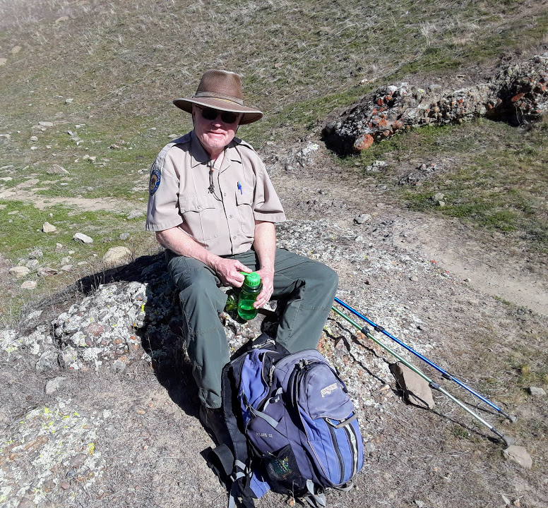
You are in good hands on this trip with amiable Park Ranger Nathan Aeschleman and veteran guide Richard Ranc (pronounced Rantz). Richard works for the National Park Service in the summertime at Yellowstone National Park. He has also logged stints at Pinnacles, Sequoia, Glacier, Shenandoah – you name it, he’s done it. At 78 years young, he will hike your city legs into the ground if you are not prepared, so get busy and do a few squats to get yourself ready. Bring lots of water.
Mike Carroll and I joined a small, but feisty group of trekkers on a cold Sunday morning cruise across the lake. We listened carefully as Richard and Nathan spoke about the native Yokuts culture in the pre-Mission days, the history of the flood control reservoir, the plant and animal life of the region, and the geologic features visible from the boat. The steeply dipping marine sediments here date back to the days when the central valley was the bottom of a vast ocean, before the North American tectonic plate began to subduct the Pacific Plate to create the Diablo Range and warp the landscape surrounding us. Continued geologic unrest is evidenced by the massive landslide slump seen on the southern shore. (Please view the attached slide show for additional photos.)
We were treated to osprey, grebe, and coot sightings on the way to the landing, where we scrambled up the bank, crossed a wooden bridge, and began our hike on a well-used and sometimes crumbling trail. The name “Los Banos” (the baths) refers to the many clear pools you see as you work your way upstream. This dry year in the rain shadow of the Diablo Range is not ideal for wildflowers or deep pools, but the variety of species is obvious and you can see the high water marks from previous years. As we moved along the trail, Richard pointed out a vine of the conspicuously green wild cucumber plant, aka suicide plant or manroot. Learn all about wild cucumber here.
We also came across a buff-colored sandstone bed studded with artifacts in the form of mortars where the Yokuts people used to grind acorns next to the idyllic pools. Atop this sandstone layer is an orange lichen-covered conglomerate full of rounded cobbles of different sizes. This feature is known as a turbidite, formed as a result of a submarine avalanche of rapidly moving sediments along a steeply sloping segment of the ocean floor. Hikers familiar with Point Lobos on the coast will notice this formation’s similarity to the Carmelo formation there.
In a couple of hours, we stopped for lunch, after which we were free to explore on our own. Another mile upstream is an old barn and Basque homestead. A short but steep trail up a nearby side canyon offers long views of the expanding valley and Los Banos Creek leading up to the Diablos. In this area is the largest grove of old growth sycamore trees in California. Along the banks of the rocky stream grow tall cottonwoods, water-greedy tamarisks, and the occasional blue elderberry tree. A single sprawling tamarisk bush, a non-native species which will sport beautiful pink blossoms later in the spring, can transpire three hundred gallons of water per day. Greedy!
It is worth noting that the “Path of the Padres” existed long before any padres showed up in California. The route up Los Banos Creek to French’s Pass and down through Hollister to San Juan Bautista, about 50 miles as the crow flies, once brought Yokuts traders from the central valley to the land of the Mutsun. After the establishment of the Mission San Juan Bautista, a Spanish priest named Father Felipe Arroyo De La Cuesta traveled this path. There was no Mission in the central valley, of course, so he walked east, seeking to proselytize the Yokuts and attract them to work in San Juan Bautista. He carried with him a rather bulky barrel organ which is now on display in the Museo Fray Felipe Arroyo De La Cuesta next to the Mission church. Ironically, one of the tunes programmed on the organ was the very popular “Devil’s Waltz.”
Father Arroyo was an accomplished linguist who learned thirteen indigenous dialects and published a valuable book on the Mutsun language. For a detailed academic account of his work, please click here. The historical connection between San Juan Bautista and Los Banos is rich and fascinating. How I would love to get permission from today’s landowners to take that walk myself!
The BenitoLink Walking San Benito series showcasing some of the many hiking opportunities in San Benito County has been fun and educational for me. My hope is that each of you who have read the articles also enjoyed them. Even more than that, I hope you will grab a partner and get outside to walk and observe this awesome countryside for yourselves. Happy trails!
And please, my friends do not litter.
For information on how to register for the Path of the Padres hike, please click here.
For a location map of the Los Banos Creek Reservoir boat ramp, please click here.
To read the all Walking San Benito articles written and photographed by Jim Ostdick, type it into the BenitoLink search box and change the “sort by” option from Relevance to Date and you can see them in chronological order.
You must be logged in to post a comment.